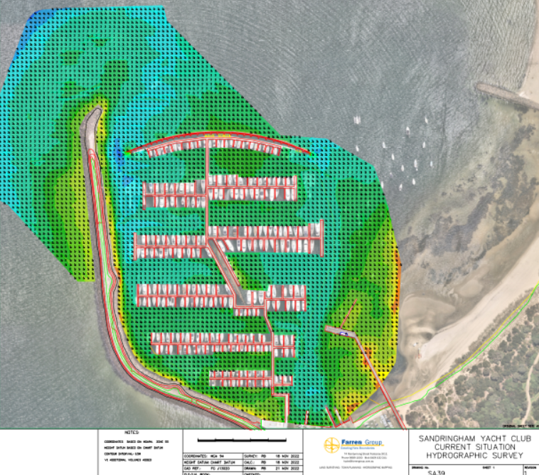
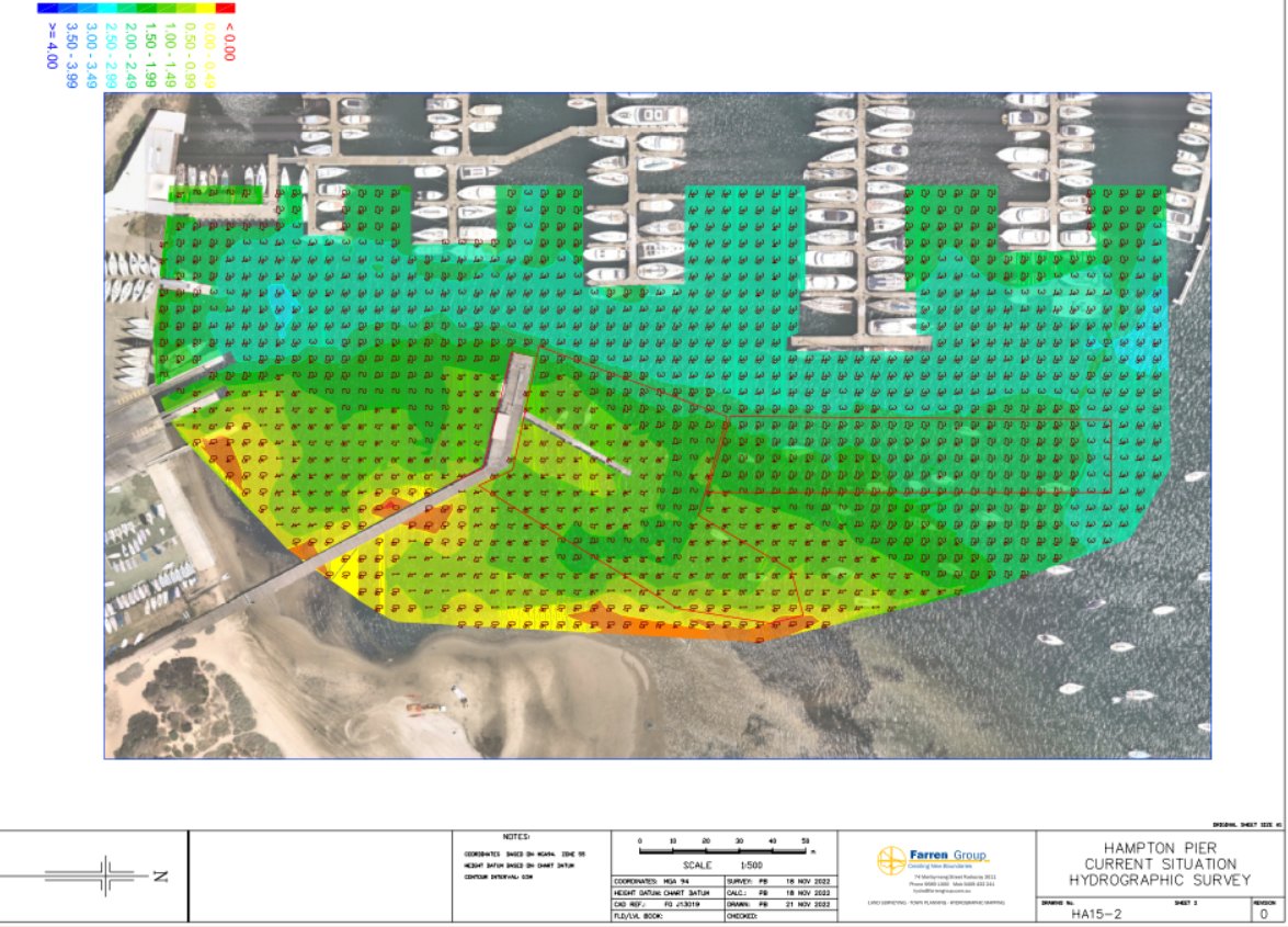
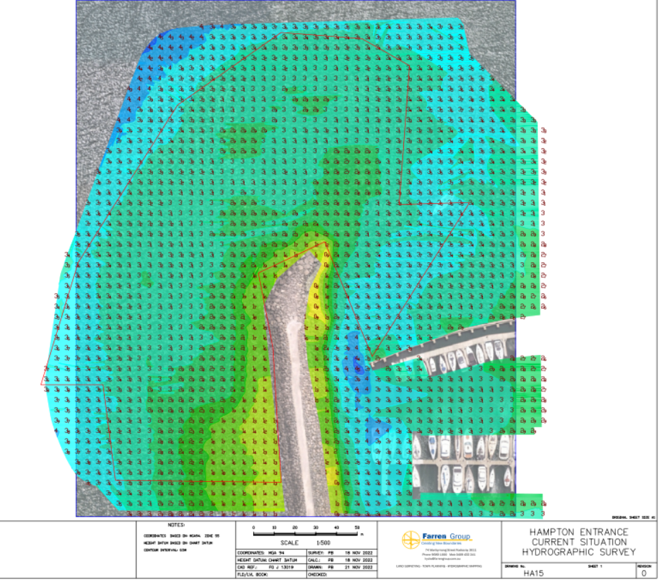
The seabed depths throughout the SYC marina vary. These surveys are done at chart datum (low tide), so remember to add + the tidal height to the charted depth to give you the true depth of water. Please also remember seabed depths are dynamic. Hydrographic survey of entire marina (Nov 2022) Hydrographic survey around Hampton Pier just prior to its demolition (at Nov 2023) Hydrographic survey around tip of the Breakwater (Nov 2023)